How can a city just minutes from downtown Austin feel this tucked away? If you’re drawn to big trees, long driveways, and homes that seem to disappear into the hills, West Lake Hills will speak your language. In this guide, you’ll learn the real reasons the area feels so private, what that means for your search or sale, and the practical steps to take before you add a pool, patio, or new wing. Let’s dive in.
Where privacy starts: the land
West Lake Hills sits on the edge of the Texas Hill Country, where ridgelines, ravines, and limestone outcrops shape daily life. That broken terrain helps block sightlines between homes and softens road noise. For a deeper look at the landforms, explore the Balcones Escarpment overview from the University of Texas Bureau of Economic Geology, which explains why ridges and steep hollows are so common in west Austin’s hills (Balcones Escarpment overview).
Protected open spaces also matter. Wild Basin Wilderness Preserve sits right next door, and the larger Barton Creek Greenbelt stretches nearby. These conserved areas create permanent green buffers, so many lots back to trees instead of rooftops. St. Edward’s University highlights Wild Basin’s role in conservation and education, which helps maintain that natural backdrop over time (Wild Basin partnership details).
City rules that lock in space
Privacy here is not an accident. The municipal code sets generous lot sizes, setbacks, height controls, and tree protections that keep homes lower, farther apart, and wrapped in landscape. You can review the dimensional standards directly in the city’s code (dimensional regulations).
Lot sizes and setbacks
- Many residential districts require large lots. R‑1 and R‑2 commonly set 1‑acre minimums, and R‑3 calls for 2‑acre minimums.
- For lots at or above 0.5 acre, a typical front setback is 50 feet, which pushes homes back from the road and leaves room for mature landscaping.
- Along major corridors, the city adds extra distance. Structures must sit at least 50 feet from Bee Cave Road and at least 75 feet from Capital of Texas Highway (Loop 360). Those buffers reduce visibility from high‑traffic roads and lower noise inside homes (corridor setbacks and buffers).
Impervious cover limits
Impervious cover rules cap how much of a lot can be covered by roofs, driveways, patios, and other hard surfaces. The baseline allowance for many residential lots is intentionally limited, which helps preserve open, natural areas between homes. In some cases, projects that connect to public wastewater and meet specific conditions may receive modest increases in allowed cover, but the overall effect still favors greenery over pavement (impervious cover framework).
Height, slope, and screening
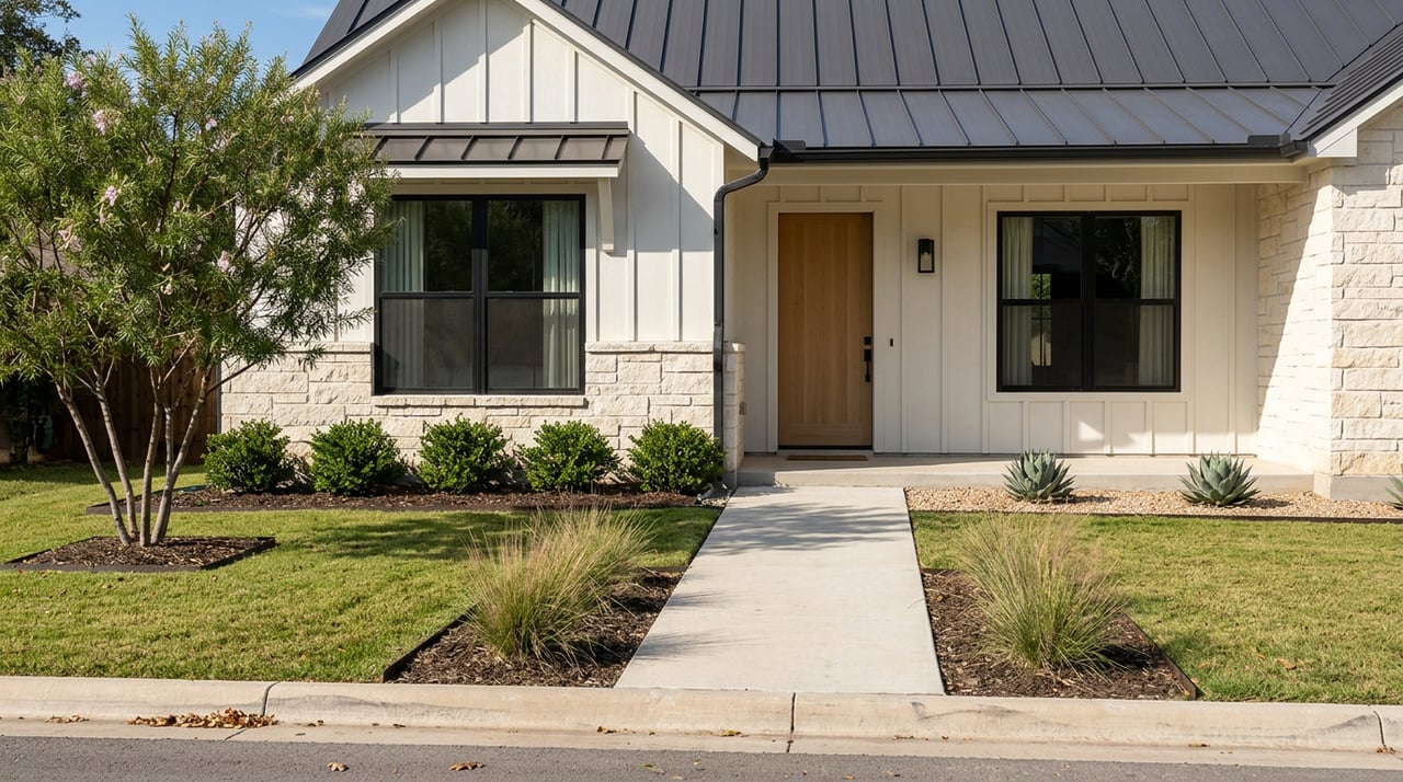
The code limits building height in most residential zones, often in the 25 to 30 foot range. On steeper sites, there are extra controls. Where average natural slope below a foundation exceeds 25 percent, structures cannot rise more than 32 feet above natural grade at that point. If a foundation is exposed four feet or more and visible from the street or a neighbor, it must be screened with dense, evergreen vegetation. These rules keep homes from towering over each other and help them blend into the hillside (height and slope standards).
Tree protection and permits
Trees are a defining part of the local look and feel. The city regulates tree and vegetation removal through permits and replacement requirements. Smaller removals may be allowed with a simple permit, while larger, protected trees need formal approval. The goal is to preserve natural screening, prevent erosion, and maintain the city’s wooded character (tree and vegetation regulations).
Limited commercial intensity
Zoning also curbs large commercial footprints. In the mixed‑use district, the code sets minimum tract sizes and limits how much can be office or business use, keeping the area primarily residential and conservation‑oriented. That lowers traffic and visual clutter compared with busier urban corridors (mixed‑use standards).
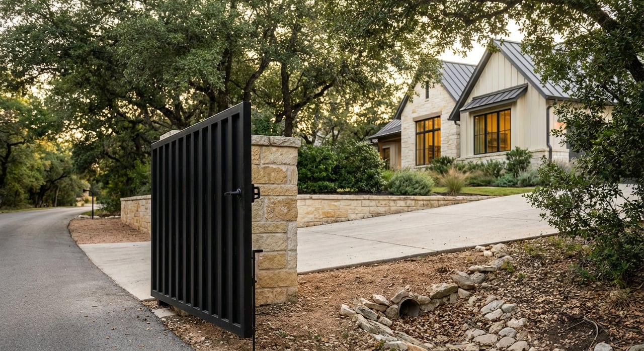
Streets and homes that hide in plain sight
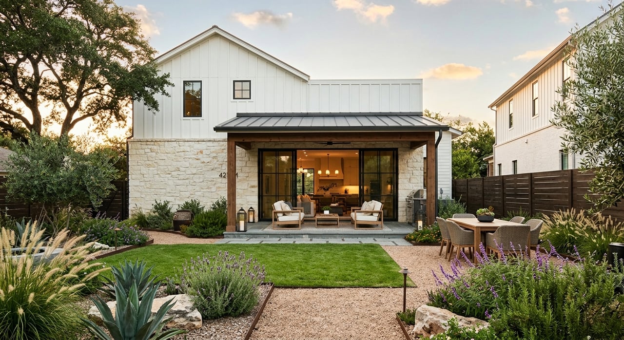
Neighborhood design builds on the land and the rules. Many streets curve with the contours and end in cul‑de‑sacs, which reduces through‑traffic and long sightlines. Homes often sit below road grade or turn garages to the side so street‑facing mass feels smaller. On steeper lots, stepped foundations and terraced yards tuck more of the structure into the slope. Together these patterns keep the area visually quiet, even close to major roads.
Greenbelts and buffers that add calm
Beyond the preserves, the city requires landscaped buffers along key corridors. The first portion of land next to Bee Cave Road and Loop 360 must remain landscaped and partially natural. That continuity of trees and understory helps hide driveways and structures from view and creates a soft edge as you move through town (roadside buffer rules).
What this means when you buy
If you are planning a purchase, the city’s standards shape how you live and what you can add later. Here is how to read that on a showing or during due diligence.
Signals of privacy on a tour
- Long, gently curving driveways with homes set deeper on the lot.
- Mature live oaks and native understory that block direct lines of sight.
- Homes oriented to valley or skyline views rather than the street.
- Lots that back to preserves, greenbelts, or natural drainage corridors.
Permits and planning you should expect
- Tree work: Most removals need a permit, and larger trees often require mitigation. Build in time for arborist reports and city review (tree and vegetation regulations).
- Impervious cover: Pools, big patios, and long paved drives count toward your cap. Ask early about your lot’s allowed coverage and whether public wastewater is available to unlock incentives (impervious cover framework).
- Setbacks and height: Confirm that any expansion fits within setbacks and height limits, especially on sloped lots.
What to expect on nonconforming lots
Some older or smaller parcels may be nonconforming. That can mean extra steps, variances, or special approvals before you build. Plan for a bit more lead time so your design aligns with the code and the site.
Privacy, wildfire, and smart vegetation care
Privacy relies on trees and understory, yet the community also prioritizes wildfire safety. The city’s Firewise guidance calls for removing dead brush, reducing fuels, and hardening homes, all with the goal of safer neighborhoods. Expect thoughtful vegetation management that preserves canopy where practical while improving defensible space around structures (Firewise and wildfire preparedness).
The future: planning and infrastructure
West Lake Hills is small and mostly residential, with a feel that comes from both the land and the code. City leaders review comprehensive plan updates and discuss wastewater infrastructure from time to time, since those choices can influence redevelopment intensity. Any major shift would require policy changes, and for now, the code and conservation focus make large density increases unlikely without council action (planning and wastewater context).
Quick context: where you are
West Lake Hills covers roughly 3.6 square miles just west of central Austin. It is crossed by Loop 360 and Bee Cave Road, which frame the city and provide convenient access while keeping most homes tucked into hills and trees. The Texas State Historical Association offers a concise overview of the city’s setting and development history (West Lake Hills overview).
Buyer checklist for privacy goals
Use this short list to align your wish list with local rules and the terrain.
- Verify lot zoning, minimum size, and setback lines.
- Ask for the lot’s impervious cover allowance and wastewater status.
- Review tree sizes and species; budget for permits and mitigation.
- Walk the site at different times of day to gauge noise and sightlines.
- Note adjacency to preserves or greenbelts and any required buffers.
- On slopes, confirm height limits and any required screening.
Selling the West Lake Hills experience
If you are selling, highlight what makes your property feel secluded. Simple, clear signals resonate with buyers:
- Tree canopy and native understory that buffer the home.
- Setback depth, long drive, and side‑entry or recessed garage.
- Outdoor living oriented to views rather than the street.
- Adjacency to preserved land or a natural drainage corridor.
A clean permit history for tree work or recent wildfire‑smart landscaping can also build confidence for buyers who value both privacy and safety.
Final thought
In West Lake Hills, privacy is not a perk, it is the plan. Hills and hollows break up views. Preserves add permanent green edges. And the city’s rules hardwire space, setbacks, and trees into daily life. When you understand those ingredients, you can shop with clarity and design with confidence.
Ready to explore homes that fit your privacy goals and lifestyle? Connect with Jessica Galvan to schedule a personalized consultation.
FAQs
What makes West Lake Hills feel private?
- A combination of hilly terrain, preserved green space, and city rules on lot sizes, setbacks, height, and tree protection create natural visual and noise buffers.
How far are homes set back from major roads?
- The code requires at least 50 feet from Bee Cave Road and at least 75 feet from Loop 360, plus landscaped buffers that keep buildings visually separate from traffic.
Do I need a permit to remove a tree?
- Often yes. The city regulates removal based on trunk size and species, with permits and replacement requirements to preserve canopy and screening.
How do impervious cover limits affect pools and patios?
- Pools, large patios, and long driveways count toward your lot’s impervious cap. Connecting to public wastewater may provide limited incentives, so check early in planning.
Are taller homes allowed on steep lots?
- Height is limited, and on slopes over a 25 percent average, structures cannot exceed 32 feet above natural grade at that point. Exposed foundations require vegetative screening.
Could future plans change the area’s character?
- Comprehensive plan updates and wastewater decisions can affect redevelopment, but current code and conservation priorities make major density increases unlikely without policy changes.